Indoor Tracking System (ITS)
Overview
For situations where GPS is unavailable, such as when the user is underground, vMobile™ / VQuad™ offers an Indoor Tracking System (ITS) option to monitor wireless voice quality. This feature presents a comprehensive map of the underground area, enabling users to easily identify the location and time of calls.
The ITS functionality is an optional application available within the VQuad™ software / vMobile™ for both online and offline viewing of the results associated with the ITS. The ITS results include the VQT measurements (based on user-defined ratings) plotted against the user-provided graphical location map.
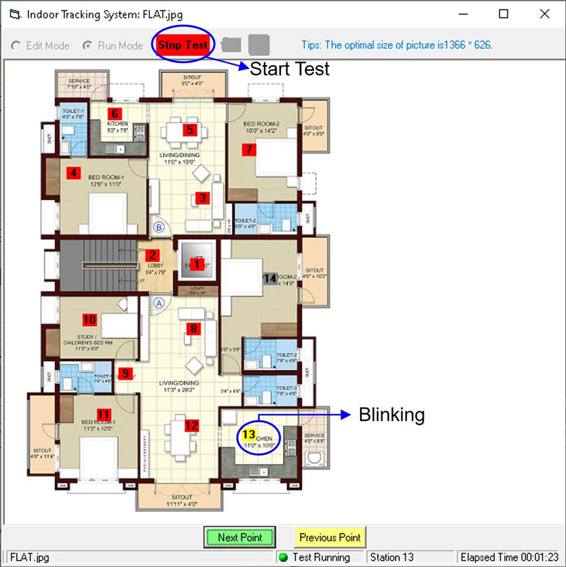
ITS VQT Map viewer
Main Features
- The ITS feature is designed specifically to conduct VQT measurements in remote and GPS signal-deprived areas, such as underground locations
- To obtain VQT scores, the test route can be manually defined using ITS (Indoor Tracking System)
- By utilizing the ITS Viewer option, users have the capability to plot the VQT measurements on the ITS Map
- In the context of measurement representation, outbound measurements are denoted by a circle symbol, while inbound measurements are denoted by a triangle symbol
- In order to establish ratings for different levels of performance, color symbols can be utilized to represent Excellent, Good, Fair, and Poor categories
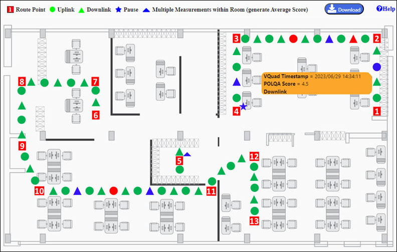
VQT Measurement using ITS viewer